Monitoring & Alerting
Be Proactive When It Matters Most
The difference between being proactive and reactive is in the preparation. That’s why our monitoring & alerting products are such an important component of the AirWise situational awareness solution. We enable you to optimize your preparation for a potential crisis well before it happens and manage it once an emergency or service-impacting event occurs.
Monitoring for Better Understanding
We provide real-time monitoring of weather events and environmental conditions that could impact the condition of key company assets and services and the performance of your teams during a crisis.
Key features and functionality of our monitoring solution include:

An AirWise dashboard showing how many locations are affected by each kind of weather event. You can click on a peril to learn more about the specific locations being impacted and how.
Breadth of Coverage
You can monitor a broad range of weather-related events and airspace conditions.
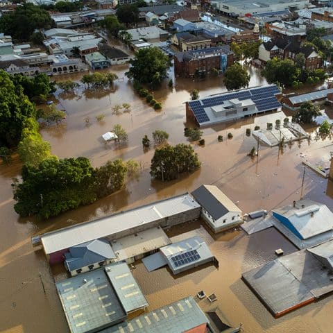
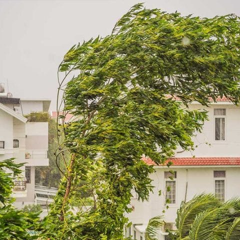
- Weather Events: Track perils like flooding, high winds and extreme high and low temperatures
- Environmental Conditions: Identify areas most exposed to wildfire risk and lightning strikes
- Airspace: Obtain real-time awareness of an airspace most relevant to your needs

An AirWise display showing the likelihood of high winds impacting a power line route.
Range of Viewing Options
Select the threshold, time horizon and map format that works best for your organization.
- Create custom thresholds for monitoring the weather conditions that are most relevant
- See how the weather is forecast to change over the next 12 hours based on thresholds set
- Select the map style that works best for you to understand the impact of weather-related events on your organization
Flexibility in Scope
Choose points, paths or areas to monitor that are most important to your organization.

A single location or asset such as a distribution center, port, power substation, stadium, refinery

A variable or fixed route such as a drone flight path, highway, parade route, power line, rail line

An expansive location such as a city neighborhood, fairgrounds, flood zone, geohash, outdoor venue
Pricing is annual or monthly, and based on the number of customers, subscribers and/or scope of the monitoring area.

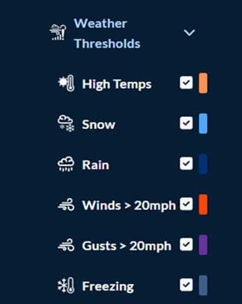
Thresholds you can set so that you receive alerts that matter most to you and your organization’s operations.
Alerting – Become Proactive in Decision-Making
Our alerting program enables you to proactively prepare for weather-related events that could impact your assets and the ability for your organization to keep the public safe. Alerts indicate where and when the peril may occur and its expected impact.
You can set custom thresholds for weather conditions and forecasts and receive alerts when limits are exceeded.
Pricing is annual or monthly, and based on the number of customers, subscribers and/or scope of the monitoring area.
Monitoring for Better Coordination with COP
If a potential crisis escalates and a variety of teams are needed to manage an emerging threat, we can provide a Common Operating Picture (COP) that enables your operations and public safety teams to get a comprehensive 3D view of an emergency area.

AirWise Solutions’ situational awareness displays drones, their telemetry, and their position within Boston for incident commanders to position and use video live streaming as required.
This solution dramatically improves the ability of incident commanders and operation managers to understand the threat, coordinate response by participating teams and make faster, safer decisions.
Key features and functionality of our COP monitoring solution include:
- 3D visualization of air traffic, terrain, buildings and other ground extrusions
- Integration with AirWise Drone Ops to view flight plans, LAANC & NOTAM authorizations and video streaming for active drones
- Remote ID positioning of all drones
- Customizable interface enabling users to tailor the display to their specific operational needs
Pricing is annual or monthly, and based on the total number of vehicles to be managed
By providing you with robust monitoring, alerting and coordination tools we hope to ensure that you can respond as proactively as possible to potential public safety emergencies and service-impacting events.
APIs and a developer portal are available. Contact us for more information.
Check out our white papers
Sign up for a webinar
Request a product demo


