LAANC + Drone Ops
Elevating Operational Capabilities
We harness the power of drone technology and GIS spatial data to redefine situational awareness in public safety, energy, and utility sectors. Our Drone Ops situational awareness is delivered through multi-cast video streaming, repeatable autonomous flight plans that are precise, improves safety, and all while meeting your FAA compliance needs.

LAANC and NOTAMs Integration: Navigating Airspace with Confidence
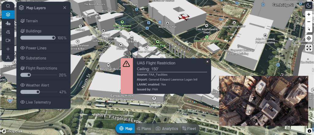
- Our Drone Ops platform, in partnership with UASidekick®, is equipped with Low Altitude Authorization Notification Capability (LAANC) and Notices to Air Missions (NOTAMs), ensuring full FAA compliance for your data collection needs.
- Whether planning flights 1-2 days ahead or understanding land ownership through parcel data lookup, our system offers seamless coordination with the FAA or airspace controllers.
- Operating under a Certification of Authorization or Waiver (COA), where NOTAMs are required, is easily complied with and approved.
- This capability not only ensures legal operations but also instills confidence in your flight planning.

Mastering the Sky with Intelligent 3D Planning: Safety and Precision in Every Mission
- Safety is paramount in aerial operations.
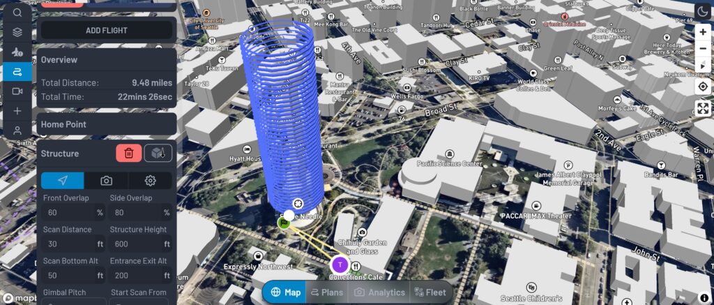
- Our Drone Ops 3D flight planning allows experts to remotely plan for a fleet or in-field operations with an unprecedented level of detail.
- Visualize terrain, buildings, power stations, lines, weather, and FAA airspace restrictions in a comprehensive 3D interface.
- The ease of applying autonomous flight plans with customizable overlaps, altitudes, and scan types — from surveys to structural inspections — minimizes re-flights and maximizes efficiency.
- Precision flight plans are your key to reliable and repeatable tower inspections, ensuring every flight is ‘mission accomplished’.


Multicast Video-Streaming for Real-Time Decision Making: Immediate Insights for Immediate Actions
- Our Drone Ops offers near real-time video streaming capabilities and the ability to multicast to local or remote teams.
- This feature enables incident commanders and experts to make swift, informed decisions from e anywhere.
- Whether you’re managing a single drone or a fleet, the video feed provides an unparalleled level of situational awareness.
Working in conjunction with our AirWise 3D Common Operating Picture (COP), this system puts actionable intelligence in the right hands, exactly when it’s needed.
At AirWise Solutions, we are committed to providing you with the tools to transform your operations. Pricing is annual or monthly, and based on the total number of drones your business or service will use.
Our Drone Ops platform is more than just a system; it’s your strategic ally in the sky. Ready to experience the future of drone operations?
APIs and a developer portal are available. Contact us for more information.
Check out our white papers
Sign up for a webinar
Request a product demo